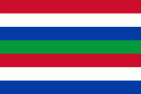
Schiermonnikoog (Gemeente Schiermonnikoog)
 |
 |
The island is 16 km long and 4 km wide and is the site of the Netherlands' first national park. The only village on the island is also called Schiermonnikoog. Around 943 people permanently reside on the island, making the municipality both the least populated and the least densely populated in the Netherlands. Because the island is small and flat, only 200 islanders have taken out the special licence allowing them to keep their own car, with the result that the few streets are virtually car-free.
Roughly 300,000 people visit the island every year, staying in the 5,500 beds available in holiday homes, apartments and hotels. Most visitors, however, are day trippers (about 4,000 a day in July and August alone), with the result that after the last ferry leaves at 7.30pm, calm returns to Langestreek, the village high street.
Thanks to the tidal current, the prevailing winds, and North Sea storms, the island is slowly moving to the south and the east. In the year 1250, it lay roughly 2 km to the north of its present position, and it then had a significantly different shape.
The earliest mention of Schiermonnikoog in writing dates from October 1440, in a document written for Philip the Good. The island's first known owners were the monks of Klaarkamp Abbey, a Cistercian monastery near Rinsumageest, on the mainland. "Monnik" means "monk", "schier" is an archaic word meaning "grey", referring to the colour of the monks' habits, and "oog" translates as "island". The name Schiermonnikoog can therefore be translated as Grey Monk Island.
During the Reformation, the monasteries in the northern Netherlands were dissolved. In 1580, Schiermonnikoog became the property of the States of Friesland. Around 1640, the States sold the island to the wealthy Stachouwer family, and for the next three centuries, Schiermonnikoog remained private property.
Around 1700, the population of Schiermonnikoog was divided among four villages or settlements. The largest of these was Westerburen, which had developed around the medieval buildings of the grey monks. In 1717 and 1720, storms flooded Westerburen, which had to be abandoned around 1725, because of drifting sand and the advancing sea. In 1756 a new town, named Oosterburen, was built to the east. Nowadays this second village is named Schiermonnikoog, after the island. Also in the 18th century the people of the island rebelled against Lady Catharina Maria Stachouwer, and the States of Friesland sent troops to protect her and to restore law and order.
In August 1799, during the Napoleonic Wars, a small squadron of Britain's Royal Navy under the command of Captain Adam Mackenzie of HMS Pylades attacked and captured the former Royal Navy gun-brig Crash, moored between Schiermonnikoog and Groningen. The boats of Mackenzie's squadron then attacked the six-gun Dutch schooner Vengeance and a battery on Schiermonnikoog. The British were able to burn the schooner and spike the guns of the battery.
In 1859, the Stachouwer family sold the island to from The Hague. Among other works Banck started planting the sand dunes with marram grass to stabilize them. There is now a monument to him on the top of the dike that he built.
In 1892 Banck sold the island to a German count, Berthold von Bernstorff. In 1940, Bechtold Eugen von Bernstorff, his grandson, inherited Schiermonnikoog That same year, during the Second World War, KLM briefly provided passenger and postal services to Schiermonnikoog and nearby Ameland, landing its Douglas DC-3s on the beach. In May the Germans invaded the Netherlands, and the Wehrmacht occupied the island, but Bernstorff ensured that the islanders were largely left in peace.
Map - Schiermonnikoog (Gemeente Schiermonnikoog)
Map
Country - Netherlands
 |
 |
The four largest cities in the Netherlands are Amsterdam, Rotterdam, The Hague and Utrecht. Amsterdam is the country's most populous city and the nominal capital. The Hague holds the seat of the States General, Cabinet and Supreme Court. The Port of Rotterdam is the busiest seaport in Europe. Schiphol is the busiest airport in the Netherlands, and the third busiest in Europe. The Netherlands is a founding member of the European Union, Eurozone, G10, NATO, OECD, and WTO, as well as a part of the Schengen Area and the trilateral Benelux Union. It hosts several intergovernmental organisations and international courts, many of which are centred in The Hague.
Currency / Language
| ISO | Currency | Symbol | Significant figures |
|---|---|---|---|
| EUR | Euro | € | 2 |
| ISO | Language |
|---|---|
| NL | Dutch language |
| FY | West Frisian language |


